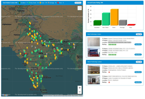
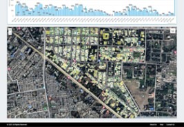
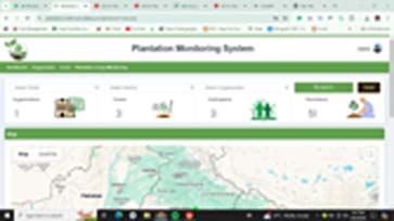
We develop GIS-based solution for our partner, primarily aimed at enhancing project planning and monitoring. Our solutions are intricately designed to pull real-time data from sensors, mobile applications, and APIs, enabling dynamic visualization across various maps. This integration facilitates a comprehensive overview, aiding in more effective decision-making and improved operational efficiency.
We leverage Google Maps, Leaflet, and ArcGIS to develop a comprehensive Decision Support System. These tools collectively enhance our data visualization capabilities, streamline decision-making, and support effective real-time project management and planning. We have integrated mapping technology into several projects, including the following:"